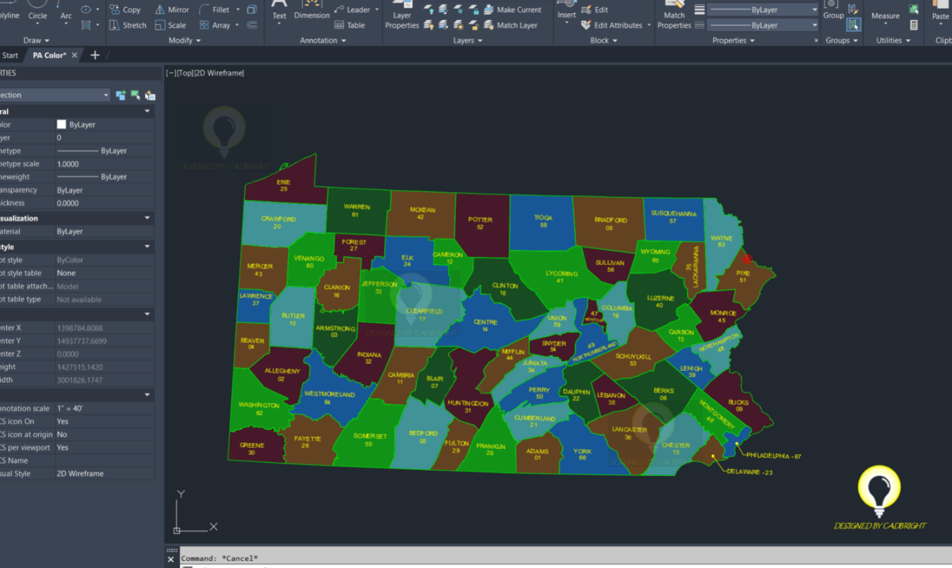
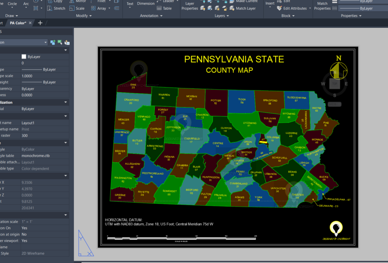
Pennsylvania County Map in AutoCAD Format
Description:
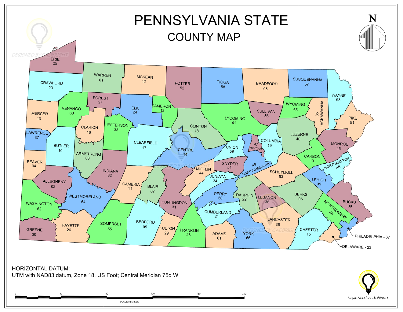
This AutoCAD file provides a detailed map of Pennsylvania State, broken down by its counties. Each county is outlined with precise geographical accuracy – Horizontal datum UTM with NAD83 datum, Zone 18, US Foot; Central Meridian 75d W. The map is designed for architectural, engineering, or planning purposes, offering a scalable vector format that allows for easy customization and integration into various projects. Ideal for spatial analysis, urban planning, and geographic information systems (GIS) applications.
Features:
- Vector-based AutoCAD DWG format
- Clear delineation of Pennsylvania state counties
- Scalable and customizable for specific project requirements
- Colorful shapes for each county
- Horizontal datum UTM with NAD83 datum, Zone 18, US Foot; Central Meridian 75d W
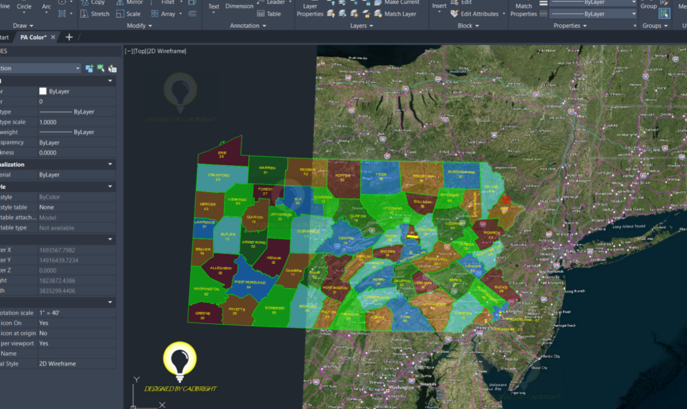
Aerial map background:
The aerial shown below depicts the extents of the datum used. To view the aerial map, on your AutoCAD software type Geomap on the command line and select your desired style of map.
Use Cases:
- Urban planning and development
- Infrastructure design and analysis
- Geographic information systems (GIS)
- Educational purposes
- Research and spatial analysis
- This information is for graphical information only and is not considered a survey
Compatibility:
- Compatible with AutoCAD and other CAD software supporting DWG format
- Easily importable into GIS software for further analysis
- Suitable for both print and digital presentations
Download this AutoCAD file to leverage detailed geographic data of Pennsylvania State counties for your professional or educational projects.