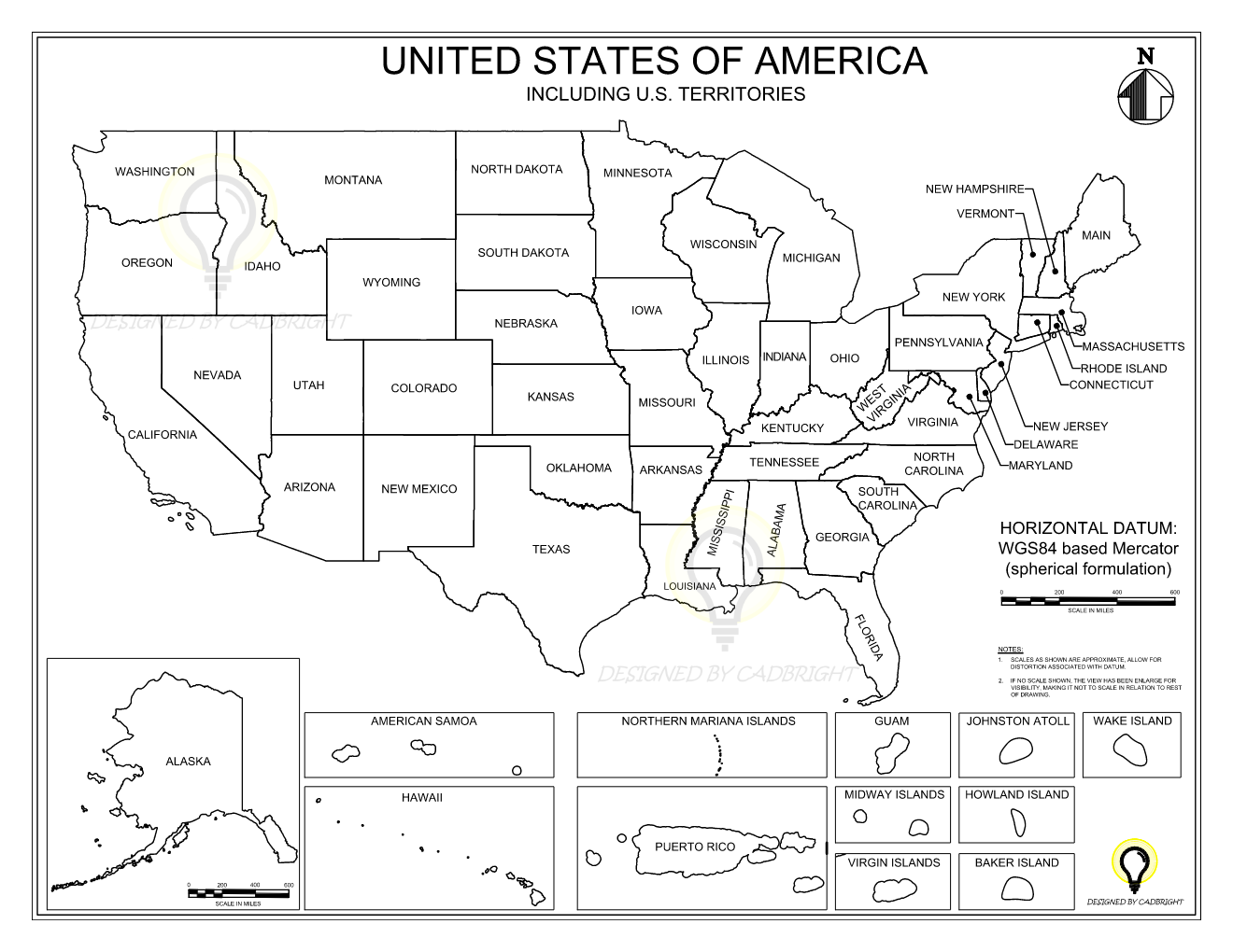
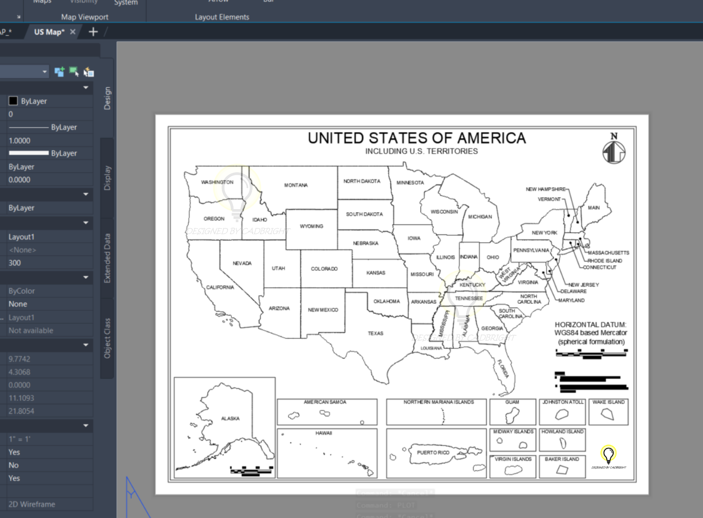
High-quality US map and territories available for immediate download in AutoCAD file format. The map is designed for architectural, engineering or planning purposes, offering a scalable vector format that allows for easy customization and integration into various projects. Ideal for spatial analysis, urban planning, and geographic information systems (GIS) applications.
Features:
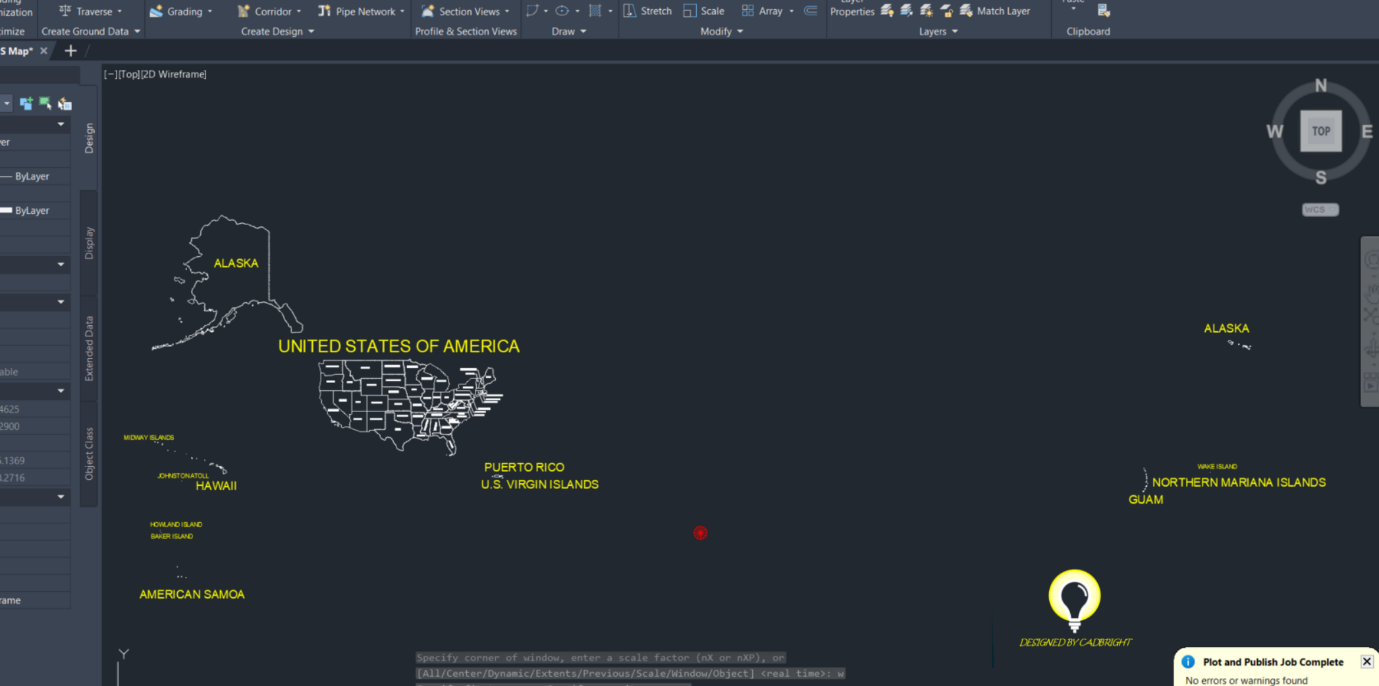
Vector-based AutoCAD DWG format
Clear delineation of State boundaries
Customizable layers: Organized layers allow easy customization of map elements, facilitating seamless integration into your design projects.
Territory Inclusions: Precise representations of US territories such as Puerto Rico, Guam, American Samoa, and more.
Scalable and customizable for specific project requirements
Datum: WGS84 based Mercator (spherical formulation)
Easy Download: Instant download available upon purchase, ensuring quick access to the files you need.
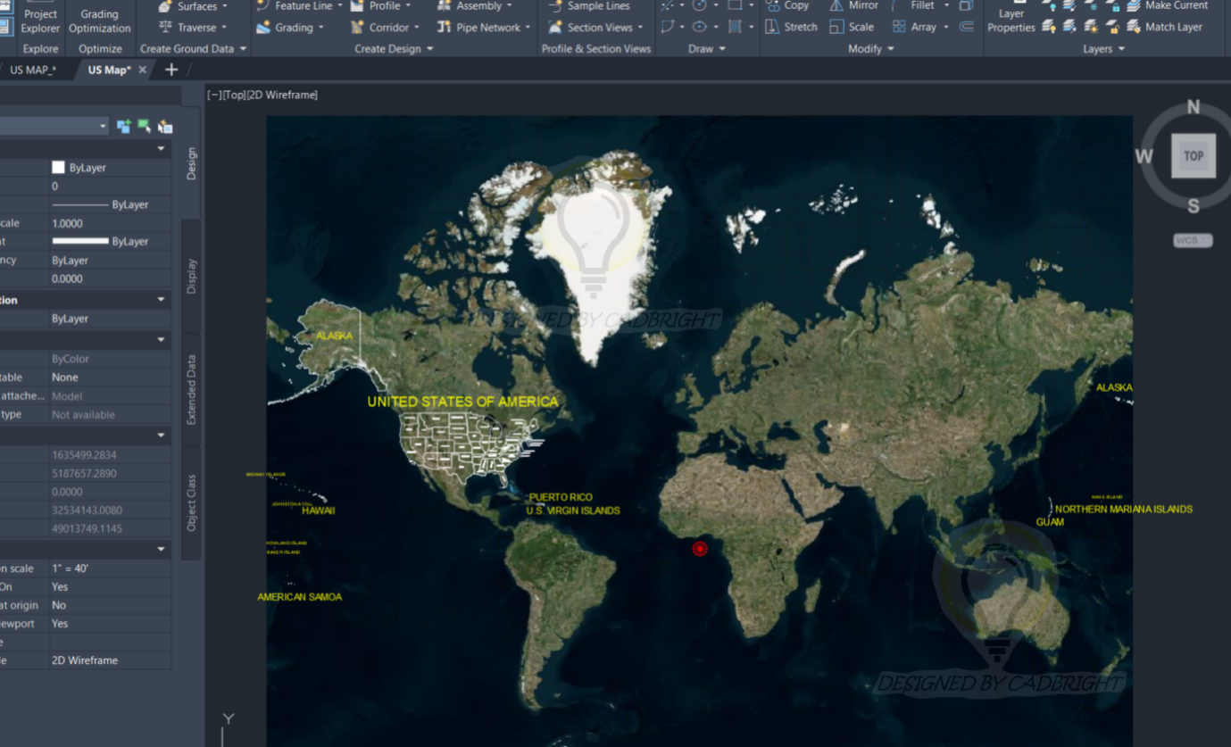
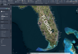
To view the aerial map sign up for Autodesk account if you don’t already have one. Next, on your AutoCAD software type Geomap on the command line and select your desired style of map.
Use Cases:
Urban planning and development
Infrastructure design and analysis
Geographic information systems (GIS)
Educational purposes
Research and spatial analysis
This information is for graphical information only and is not considered a survey
Compatibility:
Compatible with AutoCAD and other CAD software supporting DWG format
Easily importable into GIS software for further analysis
Suitable for both print and digital presentations
Download this AutoCAD file to leverage detailed geographic data of the U.S. and its territories for your professional or educational projects.